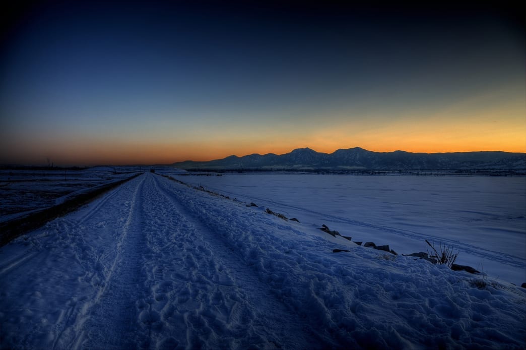
North Boulder’s network of biking trails are rather tame in the summer but once they hold a little snow, they become ideal for a fat bike tour. Boulder Valley Ranch is a fine starting point, since it offers riders the option of doing a few quick laps around the Sage Trail or linking together farther out trails for a longer day. All the trails are either single or double track and are non-technical, though there is one brief, steep hill that connects the Sage Trail with the upper mesa trails that can be a bit tricky if it’s icy.
What Makes It Great
A single lap around the Sage Trail is 3 miles, so it goes quickly but is very scenic (the entire trail surrounds a working farm). At 1.5 miles, the trail meets the Eagle Trail, which can be ridden over to the Boulder Reservoir which features a 5 mile, rideable loop. From the parking lot, there is also the option of going north on the Left Hand Valley Trail, a 3 mile trail that ends at the parking lot for Left Hand Valley Reservoir. Climbing up the connector trail (technically, the upper Eagle Trail) eventually goes to the Foothills parking area, where a tunnel under Highway 36 connects with trails that go all the way to Wonderland Lake. There’s enough terrain to cover to make a 1 – 2 hour ride in the winter a lot of fun and the scenery is fantastic throughout, especially from the mesa looking south onto the Flatirons. North Boulder has a bucolic feel to it and at times, it’s hard to believe a major city is just over the horizon. Riding out to Boulder Reservoir for a winter picnic is fun, especially on a sunny January day. Parking at Wonderland Lake is also an option — you can hit up the trails, then come back into town to enjoy a warm meal at one of the local restaurants in north Boulder (we like Proto’s pizza).
Who is Going to Love It
Riders who are looking for a scenic tour without difficult trails will appreciate the mellow terrain. First time fat bikers will have fun getting used to the feel of the bulbous tires by taking a few laps on the Sage Trail. Fitness buffs will have fun making laps and challenging the Eagle Trail’s abrupt hill climb. The Left Hand Valley trail is refreshingly quiet and is a bit of secret for bikers.
Directions, Parking, & Regulations
From the intersection of Highway 36 and Broadway in north Boulder, go north 1 mile on 36 and turn right onto Longhorn Road. Follow Longhorn Road 1 mile to the trailhead (the road goes from pavement to dirt halfway through). Park at the Boulder Valley Ranch Trailhead. The parking area is well marked and obvious on the right side of the road.
There are restrooms at the trailhead.
The area is open dawn until 11 pm — consider a fat bike night ride if you have lights!
Written by James Dziezynski for RootsRated and legally licensed through the Matcha publisher network. Please direct all licensing questions to [email protected]
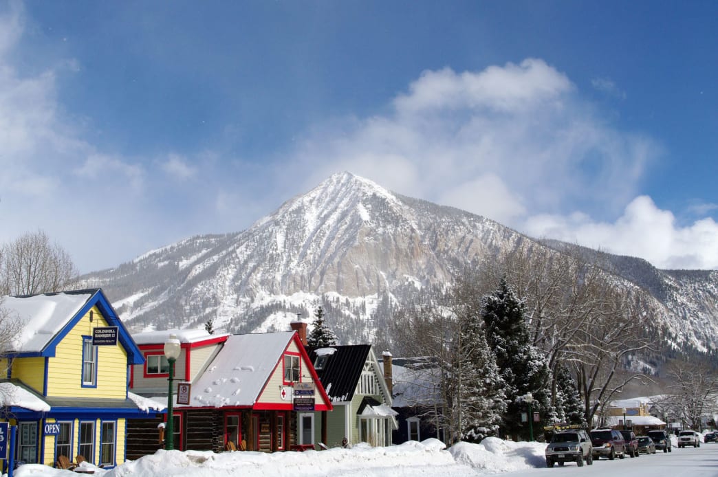
Crested Butte has more historic Old West charm than you can shake a ski pole at. Residents work hard to maintain its flair and authenticity. One look at the snow capped Elk Mountain range and it’s easy to see why the slopes of Crested Butte enjoy legendary status as some of the best skiing and snowboarding in the world.
The smorgasbord of winter fun just begins on the slopes. There’s lots to do in this winter wonderland: snowshoe & cross-country ski trails, snow tubing, ice fishing, fat biking, and an extensive web of snowmobiling trails. And did we mention dog sledding?
To maximize time, book a stay at one of the several "ski in/ski out" accommodations that are available. Axtel Condominiums is located in Village Center at the base of the high-speed Silver Queen chairlift and provides access to the longest runs in the resort. It’s is a great family-friendly option. However, downtown and the resort are only three miles apart so everything is easy to access. For a great bird's eye view try the Columbine, one the resorts located highest on the mountain.
Or if you’ve got a bit more time than money, take a look at the "Gunnison Getaway" deal. Crested Butte Mountain Resort and a range of properties in Gunnison (about 30 miles away from Crested Butte) have partnered to offer lift ticket and lodging packages that cost less than you expect. Everything is conveniently connected with a free shuttle. And if you’re traveling from out of state, stay a little bit longer than the weekend for cheaper airfare.
Fuel up right with a hearty breakfast. Caffeinate your day with Camp 4 Coffee or for a more traditional sit down for a meal at Revelden. Often touted as some of the best food in town, Revelden's daily, fresh offerings and gluten-free options are a hit. Once you have a full belly, it’s time to get down to business.
Crested Butte Mountain Resort is home to 1,547 skiable acres, 15 lifts, and 121 trails, so every level of skier or snowboarder is catered to with remarkable runs for everyone. One of the best aspects of Crested Butte is the way that the runs are laid out. The flow down the hill creates trails that link up, making it easy for everyone to meet up for lunch together at the Avalanche Bar & Grill for a burger or at Jefe’s to indulge in traditional Mexican food.
57% of the mountain is devoted to intermediate and expert terrain. Those who love daring, tight, technical, terrain will love challenging the best steeps around within the extreme limits of inbounds, double-black diamond terrain. Wear out your legs doing laps on the High Lift and North Face T-bars with runs like Headwall, Teocalli, Spellbound, and Phoenix Bowl.
Hop on the lifts right from Mount Crested Butte to start your snow-filled day.
For the true adrenaline junkies, earn your bragging rights by having conquered the steepest cut ski run in North America on the sustained 50-degree pitch of Rambo—where there is no shame in feeling nervous about dropping in. Note that many of the runs in "the extremes" aren’t listed on the trail map, so checking in with a local expert is the best way to find out what's good while there. If you have the time, the resort offers free tours of the mountain, but there is one more way to find the gnarliest runs—the CB Extreme app (available for Android and iOS). This app has the skinny on extreme terrain and is getting a new update for the 2017 / 2018 ski season. It’s like having a local in your pocket!
A favorite post-mountain watering hole is the Secret Stash. Known for their unique topping combinations with names like Notorious F.I.G., Buddha's Belly, and Steazy Ryder, it’s arguably the best pizza in Crested Butte. For a fine dining adventure with French flair, make a reservation for the Uley’s Cabin Sleigh Ride Dinner. Snuggle up with your sweetie under a cozy blanket in a horse drawn sleigh while winding through the cotton candy landscape.
Think you can keep your eyes open a little bit longer? A perennial favorite is Talk of The Town. This classic bar and restaurant is in a historic two-story building with a jukebox, video games, giant Jenga, pool tables, and often features a DJ spinning an inspired dance party. A host of bars downtown also offer live music and there is a very active winter program of special events.
Sleep in. Just kidding, there is wayy too much to do here! Get up early to avoid the crowd and grab breakfast at Izzy’s, but brace yourself for pancakes bigger than your head—and ask about the story behind their sourdough.
If you think the downhill action at Crested Butte Mountain is epic enough, brace yourself. Rent a pair of nordic skis or snowshoes and spend the morning on some of the groomed trails in the area. In the summer months Crested Butte also has a reputation as a world-class mountain biking destination, so it should come as no surprise that with the rise of fat biking, it’s making strides as a ‘go to’ location for this fledgling sport. There are a few rental options in the valley and loads of trails to explore—Big Al’s Bicycle Heaven is one of several local shops that can point you in the right direction.
For a quick bite between activities, try out the aptly named Pitas In Paradise and don’t be ashamed to order extra tzatziki sauce. This friendly restaurant has better-than-average selections for vegetarians.
Rent a pair of nordic skis or snowshoes and spend the morning on some of the groomed trails in the area.
It’s time to give the legs a break and let something else do the work for while. Ready to blow up Instagram? Book a dog sledding lesson from one of the dog-sled tour operators in the area for a once in a lifetime opportunity. Options include a couple of hours tour or full day trips and guests can be as active as they choose. Take a thrilling ride with an experienced guide or take a lesson and learn to mush for yourself, either way making memories unlike any other. Upgrade the size of your winter transportation mammal if you’d like to explore the mountains on horseback with an outfitter.
Adrenaline seekers might prefer to rent a couple of snowmobiles and explore the wealth of pristine backcountry the Rockies are known for. It’s the most fun to be had in the snow while sitting down and a great way to collect a new mode of transportation for the bucket list. Self guided and guided tours are available.
After two days, you’ll have mountains of memories—and we bet you’ll already be scheming your next visit! Winter adventures in the Gunnison / Crested Butte pack in so much fun, it’s a shame that 48 hours can fly by so quickly. If you’re dreaming of steep ski runs, pristine backcountry snowshoe trails, or fat biking along winter versions of the region’s legendary trails, chances are you’ll soon find your way back to this unique Colorado playground.
Written by Lisa Collard for RootsRated in partnership with Crested Butte & the Gunnison Valley | The Home of Mountain Biking and legally licensed through the Matcha publisher network. Please direct all licensing questions to [email protected]
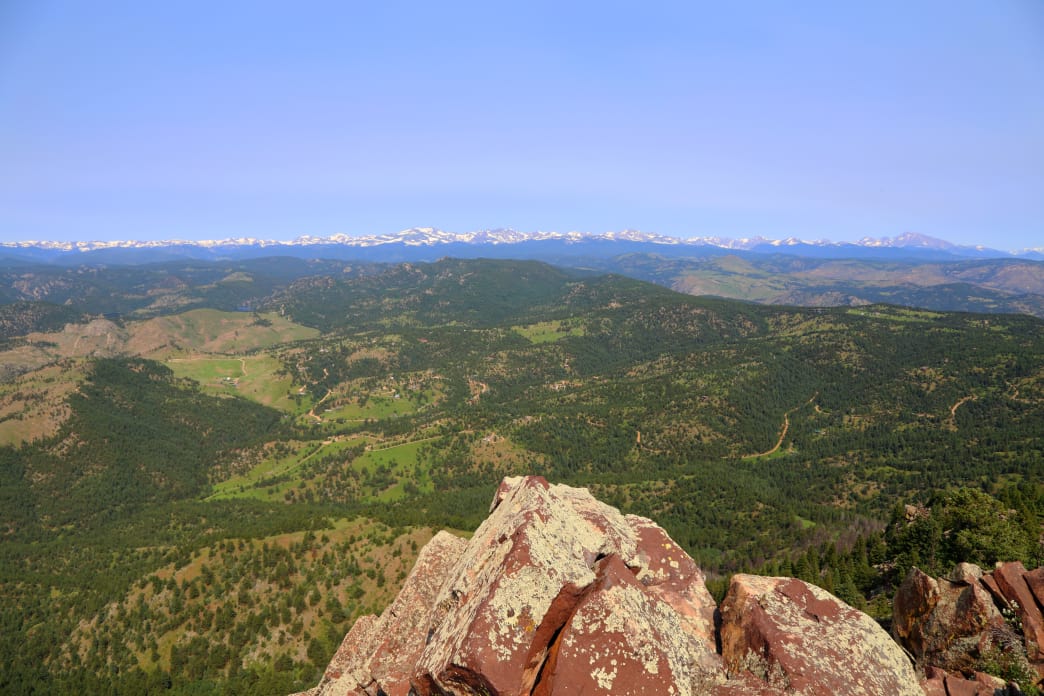
It’s no secret that Boulder boasts a wealth of top-notch hiking. The foothills and mountains above town represent the eastern terminus of the Rocky Mountains, rising up to elevations more than 8,000 feet—meaning a great workout is almost guaranteed if you’re starting from Boulder, which is roughly 5,400 feet above sea level. Meanwhile, the mesas and plains in east Boulder offer mellow terrain rich in history and ancient geology.
Here, a look at 10 of the best day hikes in Boulder—once you’ve knocked these off the list, there are many others to discover! For detailed maps and directions, check out Boulder Open Space and Mountain Parks website.
1. Mount Sanitas
Difficulty: Moderate
Time to Hike: 2 hours
Mount Sanitas is a favorite among locals for both its views and ability to provide a serious workout.
It’s easy to see why Mount Sanitas is Boulder’s most popular mountain. Despite a modest elevation of 6,843 feet, this beloved hike is a real-deal workout with more than 1,300 feet of elevation gain. Spacious views of Boulder, sprawling plains, and Denver to the east are complemented by the dramatic panorama of the Indian Peaks to the west. The 14,255-foot Longs Peak dominates the mountainous skyline from the summit of Mount Sanitas.
The classic Sanitas loop features steep sections mixed with flat, shady, segments. Take the 1.1-mile Mount Sanitas Trail to the top, descend the 0.7-mile East Ridge Trail, and return via the Sanitas Valley Trail for 1 mile. For a more gradual ascent, the Lion’s Lair Trail is a smooth, shady 2.9-mile trail (one-way) to the top, ideal for runners (though be aware dogs aren’t allowed on this trail; they’re allowed on the other Mount Sanitas trails).
2. Green Mountain
Difficulty: Moderate
Time to Hike: 3-4 hours
There are several ways to the top of 8,150-foot Green Mountain. The standard hike begins at Gregory Canyon and ascends roughly 3.2 miles to the top (there is a slight detour for dog traffic at the halfway point that can tack on an extra 0.2 miles). Take the Gregory Canyon Trail to the Ranger Trail for a tour that features remnants of the powerful floods that hit Boulder in 2013. From the top, hikers can link over to neighboring peaks via the Green-Bear trail. There is a fun, easy rock scramble to the summit of Green Mountain. If you’re looking for a unique way up Green, try going up Chapman Drive (a dirt road converted to a non-vehicle hiking/biking path) and connecting to Green by crossing Flagstaff Road at Realization Point. However you reach the summit, be sure to check out a metal disc on the summit shows the names of distant mountains that’s a Boulder icon in its own right.
3. Bear Peak
Difficulty: Moderate-to-hard
Time to Hike: 3.5-4.5 hours
A brief boulder scramble awaits hikers on the way to the summit of Bear Peak.
At 8,459 feet, Bear Peak is the second-highest of the trio of the "Guardians of the Flatirons" peaks above Boulder’s famous rock structures, but it has the most exposed summit, complete with unobstructed 360-degree views. The three standard routes up Bear are Fern Canyon, Shadow Canyon, and the West Ridge. All are rugged trails with switchbacks, stone-stairs, steep segments, and passage through recent burn zones. To reach the summit, a brief and easy scramble with excellent hand and footholds awaits along iron-rich, red rock. On a clear day, hikers can see from Pikes Peak to Long Peak and the full range of the Indian Peaks in between. Linking up to nearby South Boulder Peak is a good option, as the hike between the two only takes about 20-30 minutes one-way.
4. Marshall Mesa
Difficulty: Easy
Time to Hike: Whatever You Like
Marshall Mesa in south Boulder has a network of trails that interconnect from the suburbs to the east all the way to the 8,000-foot peaks to the west, so your hiking day can be as long or short as you like. This modest mesa has incredible views of the Flatiron Rock formations, especially from the highpoint on the Greenbelt Plateau Trail. Besides the natural beauty, hikers can check out the towering windmills south of the trails or take in the twinkling lights of Boulder at twilight. There are informational plaques along the way that share the area’s geological and mining history.
Marshall Mesa offers a great family trek, trail run, photography playground, and casual hike, though it can get a bit hot in the summer due to a lack of shade. To connect to the western trails, a tunnel under Highway 93 on the Community Ditch Trail offers safe passage to the open grazing lands leading to the foothills.
5. South Boulder Peak
Difficulty: Moderate-to-hard
Time to Hike: 3.5-4.5 hours
You just might have South Boulder Peak to yourself, as it’s the least visited summit above the Flatirons.
A 8,549 feet, South Boulder Peak is the tallest of the summits above the Flatirons, and yet it’s the least-visited of the three. The standard route takes the Shadow Canyon Trail to the saddle between Bear Peak and South Boulder Peak, where ghostly stands of trees and charred ground remain from recent wildfires. Follow a winding trail through a high forest to the boulder-strewn summit, but note that views to the east will be blocked by pine trees. Many hikers link Bear Peak and South Boulder Peak for a two-fer—or add in Green Mountain for a three-fer, using the Mesa Trail below the Flatirons to loop back to the South Mesa Trailhead, where all the fun began.
6. Sugarloaf Mountain
Difficulty: Moderate
Time to Hike: 1.5 hours
Even though it stands at 8,917 feet, it’s easy to miss Sugarloaf Mountain. Its bare summit blends into the undulating land between Boulder and the Indian Peaks, and it’s just far enough from downtown Boulder (roughly a 20-minute drive) to remain less popular than easier peaks. The large parking area is located at the convergence of the Sugarloaf Mountain Road and the dirt-road Switzerland Trail. The mostly unmarked but obvious trails start to the west of the parking lot and ascend a mile on a rocky but never-too-steep trail that gets better the closer you get to the top, where views are perhaps the best in Boulder County. Sugarloaf’s mountain community resembles a Swiss village, while expansive city views to the east and mountain views to the west highlight Sugarloaf’s station between worlds. This is an excellent winter hike on a bright, blue January day, as the snow adds a lot of character to the landscape. Sunset hikes are encouraged in the summer.
7. Joder Ranch
Difficulty: Easy-to-moderate
Time to Hike: 1-2 hours
A newer trail system in Boulder, Joder Ranch offers a four-mile out-and-back route and little foot traffic.
Joder Ranch is one of Boulder’s newer trail systems, and its eponymous hike is a simple, 4-mile out-and-back that ascends a ridge and descends into a formerly "secret" portion of Boulder Open Space that connects with Olde Stage Road. It’s this second half of the trail that is worth the visit, though the initial views from Joder Ranch will likely provide a vantage of Boulder most have not seen before. The west side of the ridge is a peaceful, shady, pine forest with a few open meadows and plenty of solitude. Wildlife sightings are common, including black bear and deer. Mountain bikes are allowed on the trail, though traffic is fairly light by both two-wheel and foot traffic. To get there, access the interim trailhead off Highway 36 that has parking for about a dozen vehicles.
8. Flatirons Vista
Difficulty: Easy
Time to Hike: At Your Leisure
Another family-friendly destination with excellent views, Flatirons Vista is the sister-mesa to Marshall Mesa. Both can be connected either by crossing the tunnel under Highway 93 at Marshall Mesa or the road crossing that connects the Greenbelt Plateau Trailhead and Flatirons Vista. There are lots of loop options, though it’s worth taking the 1.5-mile Flatirons Vista-North Trail to the wooded Dowdy Draw Trail. This trail switchbacks down a hillside with impressive views of Boulder to the north. Hike back up, loop through the still forest of the Flatirons Vista-South Trail for an excellent one- or two-hour walk in the woods and over the plains.
9. Walker Ranch
Difficulty: Moderate
Time to Hike: 3-4 hours
Walker Ranch offers hikers a 7.6-mile loop through meadows and forests.
Walker Ranch’s full loop is 7.6 miles and starts just near the highest point of the ranch. Hikers descend roughly 600 feet to South Boulder Creek, where the rushing water can be particularly powerful in the spring. Passing through meadows and forests, the loop eventually reaches a rocky outcrop where a steep, sustained staircase accesses the second half of the loop (watching mountain bikers haul their bikes up these steps is quite interesting). There’s no better direction to go most of the time, though on hotter summer days it makes sense to descend to the right (counterclockwise) so you aren’t hiking on the sunny, exposed hillside as much. Be careful with afternoon lightning storms in the summer and autumn, as the start and finish of the loop is fairly exposed.
10. Betasso Preserve
Difficulty: Moderate
Time to Hike: 1-2 hours
Betasso Preserve is a popular mountain biking destination, but on Saturdays and Wednesdays it’s closed to bikes—so if prefer your hikes without getting buzzed by hard-charging riders, aim to go on one of those days. The Canyon Loop Trail explores a portion of the old Betasso Ranch, with open meadows, shady pine forests, and small creeks running through the property. Hikers who want a longer day can tack on the 3-mile Benjamin Loop (and the 0.75-mile connector, one-way, between the two) to explore more deep forests, dotted with the occasional open view. Many species of wildlife call this area home, including fox, black bear, coyote, and skunk. Dogs are welcome but must be on leash at all times.
Written by James Dziezynski for RootsRated and legally licensed through the Matcha publisher network. Please direct all licensing questions to [email protected]
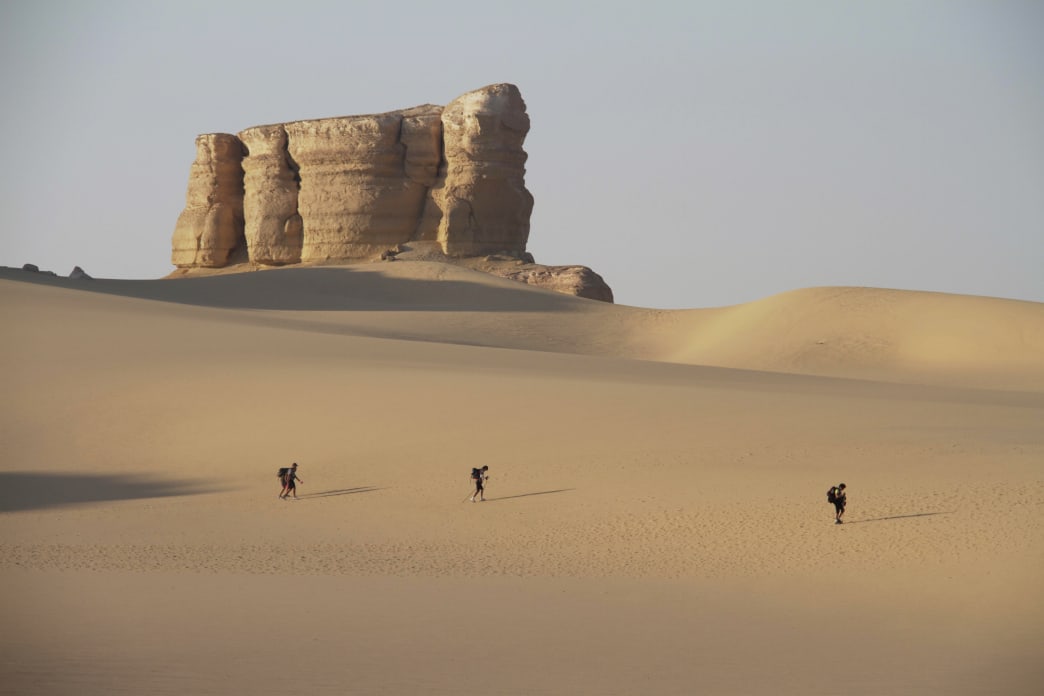
The planet is crisscrossed with epic trails, from the Alps to the Andes. There are snowy summit trips for fleet-footed peak-baggers, long and leisurely rambles for wildlife lovers, and everything in between. While the options are almost infinite, here are a few epic hikes to add to that ever-expanding life list.
One of the planet’s Seven Summits, 19,341-foot Kilimanjaro is the highest freestanding mountain on Earth—and Africa’s loftiest peak. Despite the distinction, the glaciated summit is accessible courtesy of a number of a non-technical routes, leading climbers through five distinctly different climate zones. On the path to Uhuru Peak, trekkers traverse a lowland rainforest inhabited by colobus and blue monkeys, ascend the scrubby montane moorland of the Shira Plateau, cross hulking glaciers, and catch glimpses of the megafauna-loaded grasslands of Kenya’s Amboseli National Park. At basecamp, vividly colored tents dot an unearthly moonscape, and climbers rest in the shadow of toothy 16,893-foot Mawenzi.
While the flat-topped mesa soaring above Cape Town is accessible by cable-car, the climb to the apex of 3,569-foot Table Mountain is one of the planet’s most spectacular treks—and a must-do for a visit to this dynamic city. Routes to the top of the 500 million-year-old massif treat ascending climbers to panoramic vistas of the pointed peaks of the Twelve Apostles, the azure water of Camps Bay, knobby Lion’s Head, and Cape Town’s bustling City Bowl. There are plenty of half-day routes to the mesa’s highest point, Maclear’s Beacon, including the three-hour slog through Skeleton Gorge, allowing hikers to encounter Cape dwarf chameleons, stealthy caracals, and vibrantly colored sunbirds. The climb can also be done as a multi-day trip along the Cape of Good Hope Trail or the Hoerikwaggo Trail, beginning at Cape Point.
Meaning "the long pathway," in Maori, New Zealand’s 1,864-mile Te Araroa Trail is the Kiwi version of America’s Appalachian Trail. Bookended by the Pacific Ocean, between Cape Regina and Bluff, the route runs through the heart of New Zealand, traversing both North and South islands and leading backpackers through a staggering diversity of landscapes: sun-drenched coastlines, subtropical rainforests, snow-dusted alpine passes, and river-braided glacial valleys. The epic trek also showcases many of New Zealand’s geological gems, including the Southern Alps, famed backdrop for the Lord of the Rings trilogy, and the still-active Tongariro volcano.
Besides Everest, the most idolized Himalayan foray is Nepal’s Annapurna Circuit. The nearly 130-mile route horseshoes the Annapurna range’s sea of glaciated summits, capped by 26,545-foot Annapurna I. The high-altitude tour takes hardy trekkers through highlands terraced with rice paddies, across surging whitewater rivers, through shadowy rhododendron forests, over otherworldly mountain passes, and past Buddhist gompas and Hindu shrines. While backpackers on the circuit must tackle challenges like 17,768-foot Thorung La, the route is dotted with cozy tea houses affording creature comforts like brief but heavenly hot showers and steaming plates of dal bhat, a traditional meal of steamed rice and cooked lentil soup.
Named for legendary naturalist and founder of the Sierra Club, the John Muir Trail strings together two of California’s most spectacular natural wonders: the Yosemite Valley and 14,496-foot Mount Whitney, the highest point in the continental United States. Tracing the spine of the High Sierra, the 211-mile route moseys through three national parks and two federally designated wildernesses, leading hikers through a landscape of high peaks and passes, glassy alpine lakes, and sun-drenched mountain meadows. The trail skirts Half Dome in Yosemite National Park, and showcases natural wonders like the Devil’s Postpile National Monument and Evolution Basin in Kings Canyon National Park. Plus, hikers have ample opportunity to encounter black bears, mule deer, and curious marmots along the route.
The most photographed spot in Colorado, the snow-stripped twin peaks of the Maroon Bells are best celebrated on the epic Four Pass Loop through the Maroon Bells/Snowmass Wilderness. The aptly amed 26-mile circuit begins at turquoise-toned Maroon Lake, just west of Aspen, and takes backpackers over four alpine passes each higher than 12,000 feet, across airy meadows dusted with wildflowers, through spruce forests and copses of white-barked aspen, and past backcountry waterfalls and peak-framed lakes. Besides the Maroon Bells, the Elk Mountains sampler also provides trekkers the chance to gape at a handful of celestial fourteeners, including Pyramid Peak and Snowmass Mountain.
Ringing Ireland’s wind-pummeled Beara Peninsula, a 48-mile sliver of land bisected by the Caha and Slieve Miskish mountains, the Beara Way provides a quintessential taste of the Emerald Isle and forms part of Ireland’s longest hiking trail, the Beara-Breifne Way. The 122-mile trek cobbles together bucolic country lanes, highland tracks, and ancient roads, offering a glimpse of the peninsula’s colorful past. Following the path taken by Beara’s last chieftain, Donal Cam O’Sullivan Beare, as he fled hotly pursuing Elizabethan troops in 1603, the Beara Way takes trekkers past Neolithic and Bronze Age sites, through charming towns, and over craggy highlands. Fortunately, the lung-taxing climbs and knee-grating descents are greeted with panoramic vistas of the rugged coastline, including the shimmering waters of Bantry Bay, staging point for Theobald Wolfe Tone’s infamous but ill-fated 1786 rebellion.
One of the peaks in Ecuador’s Avenue of Volcanoes, 19,347-foot Cotopaxi soars above the high Andean páramo of Cotopaxi National Park. Although the peak is the second highest in Ecuador—and one of the loftiest active volcanoes on the planet—Cotopaxi is scalable without prior mountaineering experience. Ropes, crampons, and ice axes are required to reach the snow-capped pinnacle, but with the help of local guides (and after a quick hands-on introduction to mountaineering), the crater-pocked peak is reachable for most reasonably fit trekkers. Along the way to the summit, hikers have the chance to spot wild horses, llamas, and spectacled bears (the ursine species credited with inspiring the fictional character Paddington).
The most celebrated trek in South America, this Andean excursion takes hikers from the Sacred Valley to Machu Picchu, the stone-hewn urban center crafted by the Incas during the 15th century, a World Heritage site since 1983. Along the way to Machu Picchu, the 24-mile trek follows paths forged by the Incas more than 500 years ago, meandering through cloud forests studded with 300 types of orchids, over three cloud-shrouded mountain passes, and past pre-Columbian ruins. Stashed away at 7,972 feet, the Historic Sanctuary of Machu Picchu is also a biodiversity hotspot, serving as an ecological corridor linking the Andes, Sacred Valley, and Amazon, and affording trekkers the opportunity to spot 370 different types of bird, including mammoth Andean condors.
A post shared by Candice Cole (@candice_explores) on
Soaring above other peaks in Malaysian Borneo’s Crocker Range, 13,435-foot Mount Kinabalu is the loftiest summit in Southeast Asia. Gunung Kinabalu, as the peak is known in Malay, is also the country’s first World Heritage site, a global hotspot for flora and fauna. The mountain’s ecosystems harbor more than 5,000 types of plants, over 300 species of birds, and 100 different mammals. Along the path to the granite-tipped summit, which typically takes two to three days round-trip, lush lowland rainforests give way to cloud-bathed montane and coniferous forests, providing the chance to spot orangutans, Bornean gibbons, and long-tailed Bornean Treepies. The mountain’s six different vegetation zones also support a thousand different orchids and five endemic species of carnivorous pitcher plants, including the largest on earth, Nepenthes rajah.
While scaling 15,781-foot Mont Blanc requires extensive mountaineering knowhow, more casual hikers can still get an eyeful of Western Europe’s loftiest summit from three different countries—France, Italy, and Switzerland—on the Tour du Mont Blanc. The 105-mile route rings the entire snow-frosted massif, traipsing over seven alpine passes, past storybook alpine hamlets, along colossal glaciers, and through wildflower-freckled meadows. Besides the spellbinding scenery, the Tour du Mont Blanc also provides a snapshot of regional culture, taking hikers through historic locales like medieval Courmayeur. Best of all, while physically taxing, the route is scattered with cozy alpine huts, affording plenty of opportunity to swap freeze-dried fare for fondue.
Towering above the guanaco-grazed steppes of Chilean Patagonia, the trio of granite pillars dubbed Torres del Paine comprise one of the most iconic massifs on earth. The blue-hued granite cathedral tops out at 10,656 feet and crowns Torres del Paine National Park, a former sheep estancia declared a World Heritage site in 1978. Backpackers can gape at the granite monoliths from every angle imaginable along on a circuit trek on the national park’s non-technical trails. The more heavily trafficked ‘W’ configuration can be done in less than four days, while the more extensive ‘O’ circuit, takes about a week. Despite the rugged landscape of glaciated granite peaks, raging rivers, and iceberg-strewn alpine lakes, the Torres del Paine circuit can be done without forgoing creature comforts by cobbling together a route linking the park’s cozy refugios.
Showcasing Kauai’s rugged Nā Pali Coast, where fluted mountains meld into the glistening Pacific Ocean, the Kalalau Trail is among the most spectacular coastal treks on earth. But, the 11-mile trek is no walk on the beach. Between Ke’e Beach and Kalalau Beach, the trail winds through five different valleys, across more than a half-dozen streams, and along precipitous cliff sides, including a vertiginous stretch aptly dubbed Crawler’s Ledge, for the hikers duly daunted by the 500-foot drop. Grit and determination are mandatory, but trekkers are rewarded with jaw-dropping views of the Pacific and gems like the 300-foot Hanakapi’ai Waterfall. While the 22-mile out-and-back trip can be done in a day, the route is scattered with stunning camping spots, like the area near 1,400-foot Hanakoa Falls, about halfway through the trek.
Located southwest of Tokyo, the solitary summit of 12,388-foot Mount Fuji is one of the planet’s most recognizable peaks. Dormant for just over 300 years, the snow-dusted stratovolcano has served as an artistic muse for centuries, revered as one of Japan’s Three Holy Mountains. Religious pilgrims have been scaling the sacred mountain since ancient times, and the climb remains exceedingly popular. Climbing season for Mount Fuji only runs from the beginning of July to the end of August, but more than 300,000 trekkers make the approximately six-hour trip every year. While there are celestial views on the way to the summit, the trek has the distinction of being one of the few climbs on the planet that is more cultural experience than wilderness excursion. Each of the four routes to the top offers mountain huts peddling food and drinks, and there is even a post office at the summit where you can drop a postcard to a lucky recipient.
A post shared by Casey Dubois (@caseyduboismedia) on
Rambling along the wild Sunshine Coast in southwest British Columbia, the Sunshine Coast Trail is a less-frequented alternative to the West Coast Trail. Built entirely by volunteers and maintained by the non-profit Powell River Parks and Wilderness Society, the 112-mile trail ambles from Desolation Sound to Saltery Bay, taking trekkers through old growth rainforests roamed by black bears, grey wolves, and cougars. Wildlife watchers also have the chance to spot the blubbery bodies of Stellar sea lions and harbor seals along coastal stretches of the trail, and the route’s highest point—4,821-foot Mount Troutbridge—is a hotspot for seafaring marbled murrelets. Best of all, the Sunshine Coast Trail is Canada’s only free hut-to-hut track, with no reservations or permits required.
Written by Malee Baker Oot for RootsRated and legally licensed through the Matcha publisher network. Please direct all licensing questions to [email protected]
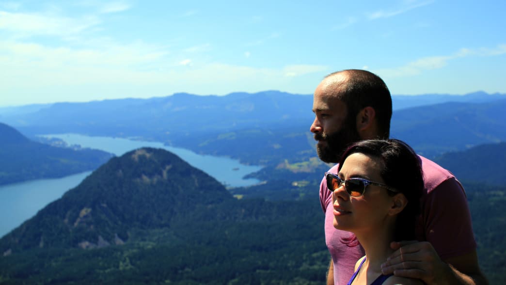
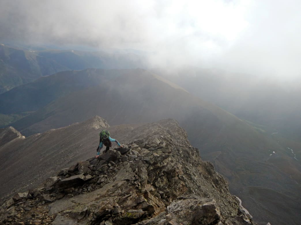
Good adventure partners are hard to find. Someone who is in tune with your goals, reliably shows up on time, and can tolerate your smelly hiking boots is a keeper. In Colorado, you and your adventure buddy will not only challenge the high mountains, you’ll also endure hours trapped in traffic, and long drives to Rocky Mountain hinterlands. Mornings will be brain-disablingly early, some adventures will unexpectedly continue long after sunset, and there’s always the realistic possibility that one of you will forget your car keys on the summit.
But through thick and thin, an ideal partner will make the wilderness more fun, more safe, and get you psyched for the next adventure. Here’s some of the traits to look for in your perfect mountainous counterpart.
1. They Complain About the Right Things
Are they going to give up when the going gets tough?
No one likes a whiner (citation needed). True, there are things worth whining about (mostly traffic and marmots eating your gear). But once it’s go time, your ideal adventure partner won’t be complaining that the trail is too steep, the wind too cold, or the river too deep. They’ll complain nary a peep about a long belay or the fact you’re mashing through 7-foot tall willows in a septic-smelling swamp.
They will, however, let you know if there are real concerns—like their fingers are about to freeze off or they have a blister the size of the great spot of Jupiter on their heel. Mere statements, not complaints. Selective, tactful complaining can go a long way. If neither of you slept the night before because the tent blew over, it’s not really worth mentioning. If your tent is still standing but there’s a family of bears sleeping inside, then it’s ok to complain a little.
Chuckle if you will, but altitude does some funny things to your digestive tract. A true gentleman will at least half-unzip from his sleeping bag and aim his fart out an open tent door versus letting it rip and hoping that the insulating properties of his bag will somehow contain the funk of a half-dozen vaporized granola bars. And yes, it’s more lady-like to step off the trail and toot once your partner has passed rather than just lettin’ ‘er rip without warning, especially if it’s a steep trail and their face may be at butt level. Gas is just part of the mountain experience and your ideal partner will realize that you can’t stop them, you can only hope to contain them… for a while.
3. They Know How to Frame A Picture
Any good adventure partner will be willing to take some time for photos!
It’s a lot of work to get to the top of that mountain. What’s worse than a friend who takes a picture that’s an extreme close up of your sweaty, weary face and a sliver of blue sky, and no identifying geography to be seen? That picture might has just as well have been taken at the duck pond or in the King Soopers parking lot. A good adventure buddy maximizes your heroic poses, or at least waits until you’re finished chewing your Snickers before taking the photo. They know that the person with the longer arms should take the selfie and sometimes it’s better to leave those sunglasses on.
4. They Know Your Tendencies
Make sure you are on the same page with camping, eating, and general fitness expectations.
For me, altitude somehow activates the part of my brain that stores useless trivia, 1980s TV show jingles (I’m talking about obscure stuff here like I Married Dora and Small Wonder), and bad puns. Annoying? Yes. But my more intuitive partners know that if I’m not making my customary observation that “that moss has really taken a lichen to that rock”, I might be feeling off. It’s good to know when your buddies are acting out of character without having to ask. Knowing when the adventure isn’t fun anymore is just as important as knowing that you both have the stamina to endure a little extra Rocky Mountain suffering. A good partner will pick up on those unspoken clues.
Here’s a hypothetical situation: you happen to like getting pumped up with sweet guitar riffs, blazing double bass drums, and a face-melting, shredding solo. They listening to some wimpy, acoustic guy in flannel strumming toothless tunes and whining (see item #1) about his feelings. In fact, the music they like rarely mentions battling the grim reaper while wielding the sword of Odin under the full moon. So what do you do? Meet in the middle and listen to The Who? Audiobooks? Headphones? You’re likely going to be stuck in the car a lot, so whatever you decide, it will likely be a compromise. It might be worth sticking to podcasts. Or if you must, you can pretend to like their musical offerings (feel free to call it “so deep”) knowing full well you’ll be blasting the first four Black Sabbath albums as soon as you get home.
6. You Share a Similar Mindset
Whether you like to keep on chuggin', or stop for regular breaks, find a partner who has a similar hiking philosophy.
Ambitions in Colorado range from “damn the torpedoes, we’re making the summit” to “these flowers look nice, I think I’ll take a little nap”. Both are completely acceptable—as long as you and your partner are on the same page. A good adventure partner is in tune with what you’re expecting out of the day. Even if your goals differ, knowing that it’s ok to stray a bit from the original plan or to maintain laser focus will help the overall morale of the day. Somedays, you may want to hang in camp while she knocks out a trio of summits and vice-versa. As long as expectations are discussed beforehand, it will prevent bad feelings and nasty Facebook posts upon your return.
7. They Genuinely Like Your Dog
Sometimes the best adventure partner has four legs.
Personally, this one would be #1 on my list. Actually, it would be #2. #1 for my ideal adventure partner list would be: "You Are My Dog". But since both my pups already know they are my top adventure buddies, this is the next best thing.
As for your human companions, it's a good idea to ask if they like pups before heading out. If so, great! If not, they can burn in… no, wait. If not, you can plan for technical scrambles or simply make time for hikes without canine companions. Crazy as it may seem, some adventures are better done without your dogs.
8. They Don’t BS You About Their Abilities
It's important to find a partner with similar interests.
In the heart of a dicey, exposed 4th class scramble is the wrong time for your buddy to announce to you that they actually don’t like climbing all that much, this is getting sketchy, and boy, heading down to catch the end of the Broncos games sounds like a great idea. Likewise, you owe it to your buddy to not say “I can ski about anything” and then balk when they point you down a 60-degree chute choked with boulders.
It’s one thing if they (or you) say, “I’m not sure if I’m up for it, but I’ll try”. It’s another to boast, “I’ll be fine!” when the evidence in your jockey shorts says otherwise. Be honest about what you’re really up for and ask your buddy what they are comfortable with. Not only is it safer, but it will also give you the chance to learn (or teach) someone how to overcome their fears or develop a new skill.
Spend enough time in the mountains and you’ll learn to appreciate a bit of levity. For example, you break your derailleur clean off your bike at mile 20 of a 40-mile mountain bike loop. It’s going to be a long day. Having a partner who can lighten the mood when things are getting unpleasant can make a sufferfest a little more endurable. Make sure they know your sense of humor though, because this one can backfire and turn you into a raging ball of nasty. I can’t help but get a laugh when the line, “This was your stupid idea” is uttered.
10. They Own a Giant Mansion in a Ski Town You Are Welcome to Use at Any Time
Also, they are named Oprah.
Ok, maybe this one is reaching. A more modest request: they have an old tent and they’ll let you borrow if you need it. It’s nice to have friends in high places, but a buddy who will camp out with you in sub-zero temps in your Honda Accord in order to catch the first ski runs of a day is a true adventure companion worth keeping. If they happen to have four legs and are furry, even better!
Written by James Dziezynski for RootsRated and legally licensed through the Matcha publisher network. Please direct all licensing questions to [email protected]
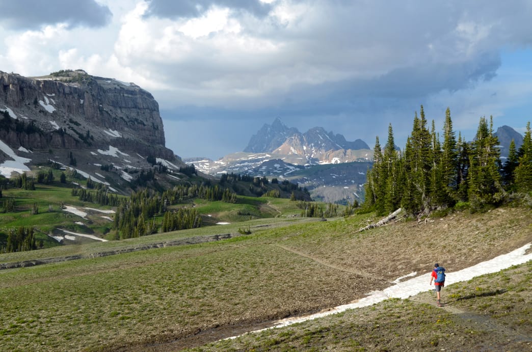
From the Smokies to the Rockies, and the Everglades to the highest point in Maine—and everywhere in between—the United States is full of world-class hikes. Whether you’re a hardcore peak bagger, out for an ambitious day hike, or are obsessed with the panoramic views for your Instagram feed, there’s always something thrilling to lace your hiking boots up for. Here, we tapped RootsRated editors for intel on some of the best hikes in the United States. Use them as inspiration for your next outing—or as a reason to plan a trip.
Teton Crest Trail, Wyoming
The Teton Crest Trail epitomizes the splendor of the West.
There are a lot of really great hikes on this list, but Wyoming’s Teton Crest Trail might just take the cake as being the most epic. For 35-45 miles (depending on your route), this slender singletrack path cuts a dwarfed, serpentine figure as it slices through the heart of one of America’s most stunning mountain ranges, linking together its very best features along the way. Over the course of two to five days, hikers will pass through wildflower-filled meadows, over airy mountain passes, past glacially-fed tarns, and across expansive basins that swallow up hikers and spit them out as tiny, inconsequential specks against the jagged backdrop of the Tetons. In short, this trail will skew your perception of what constitutes a bucket-list worthy hike. Pro tip: Permits are hard to come by, but because the trail weaves in and out of national parklands and national forestlands, if you camp in national forest designated areas, obtaining a permit isn’t necessary.
Roan Mountain, Tennessee
The 14-mile traverse of the Roan Mountain Highlands is one of the best hikes in the Southeast.
Ask any Southeastern backpacker what the best overnight trek in the region is, and the majority will tell you: the 14-mile traverse of East Tennessee’s Roan Mountain Highlands via the Appalachian Trail is a true standout. Not only is it home to one of the most unique shelters on the entire A.T. (the Overmountain Shelter, better known as "the barn" because it’s, well, a two-story barn), but it also offers up some of the best grassy “bald” hiking in America. Think of it almost like the Southeast’s version of ridgeline hiking: You’re above the trees, surrounded by a sea of billowing grasses in the foreground and a sea of bluish-gray mountains sprawling into every direction in the background, with nothing in the way to obstruct these views. The only downside? Cameras rarely do Roan justice.
Buckskin Gulch, Utah
Buckskin Gulch highlights the beauty of slot canyon hiking in Utah—just make sure to do your homework before venturing out.
In a region as labyrinthine and loaded with slot canyons as Southern Utah, it’s difficult to say that Buckskin Gulch is the definitive best slot canyon hike in the region. But it’s certainly the longest and the deepest … and, yeah, probably the best, too. For 13 miles, these narrows snake through a mazy tunnel of towering red rock walls, often no more than a wingspan’s width apart and so tall that they block out sunlight. Some hikers choose to link up with nearby Paria Canyon for an overnight 20-mile trip, but for day hikers, it’s just as rewarding to park at the Wire Pass Trailhead and embark on an out-and-back distance of your choosing. The important things to remember with this hike are largely water-related: First, flash floods are a very real threat, so be sure to check the forecast and plan accordingly. Second, bring more water than you want to carry; the dehydration creeps up quick in the desert.
Mount Katahdin, Maine
A lucky hiker summits Mount Katahdin, the tallest mountain Maine, on a rare day without fog.
The tallest mountain in Maine and the North Star, northern terminus of the famed Appalachian Trail, Mount Katahdin is truly legendary. It juts upward out of the sprawling expanse of lakes, ponds, and deep woods that define Baxter State Park and towers over the land with a commanding presence. The most iconic way to reach the summit is via the vertiginous spine of the 1-mile Knife’s Edge Trail. Along its impossibly narrow and serrated saddle, hikers scramble from Pamola Peak across Chimney Peak to South Peak and finally to the 5,267-foot summit of Katahdin. Once the (likely fog-shrouded) summit photos have been snapped, a roughly 5-mile descent via the Appalachian Trail will take hikers back to the Katahdin Stream Campground trailhead 4,100 feet below.
Grayson Highlands, Virginia
Wild ponies will be your companions on a hike in the Grayson Highlands of Virginia.
In a word, the Grayson Highlands of Virginia are breathtaking. In 19 words, they are an almost make-believe land of high mountain meadows, 5,000-foot peaks, thick rhododendron tunnels, and mystical wild ponies. Like most state parks, there’s a large variety of activities to pick from (camping, bouldering, fishing, and horseback riding), but arguably the best way to get a comprehensive taste of the park’s character in a condensed snapshot is to hike the 8.5-mile out-and-back to the summit of Virginia’s highest point: Mount Rogers. The route starts out from the Massie Gap parking area along the Rhododendron Trail. It links with the Appalachian Trail, traveling through grassy pastures sprinkled with boulder outcroppings, and then eventually connects to the Mount Rogers Spur Trail, which twists through a lush, mossy forest to the summit.
Clouds Rest, California
Clouds Rest backs up its dreamy name with views to go along with it.
The 14.2-mile round-trip hike to the Clouds Rest summit offers an exceptional taste of what Yosemite National Park is all about. As you’re standing atop its 9,926-foot perch, high above Yosemite Valley from a less-witnessed vantage point than the famous Half Dome buttress, with a giant sea of granite and coniferous pines and sequoias below, it’s hard to feel anything but utter awe and respect for your surroundings. The trailhead is located in the northeast corner of the park. From here, it’s a 7-mile mostly uphill trek whose elevation chart vaguely resembles a healthy year in the stock market—a few spikes up steep ridges here, a few dips into gullies there, but with a pretty consistent uphill hockey stick growth toward the summit. What the chart won’t illustrate, however, are all the glorious intangibles along the way—babbling snowmelt streams, sequoias so stout you’d need a group of five to fully hug them, ever-expanding panoramas as you ascend, the tranquillity at the summit, and of course, the icy plunge in Tenaya Lake as a refreshing reward once you return to the trailhead.
Wheeler Peak, New Mexico
Wheeler Peak will challenge your quads, but the panoramic views at the summit make it worth it.
It’s weird to think that the tallest peak in New Mexico would be overshadowed by anything within the immediate vicinity. But with Southern Colorado’s Great Sand Dunes National Park some two hours to the north, and the cultural hotspot of Taos about 45 minutes to the south, that’s kind of what happens to Wheeler Peak. Don’t let this lack of regional recognition fool you, though: The 8.2-mile round-trip hike to this lofty summit in the Sangre de Cristo Mountains is one of the best in New Mexico and a true lesson in uphill slogging. Averaging about 800 vertical feet per mile, this trail takes hikers through lung-expanding evergreen forests and then up lung-crushing climbs above treeline. What you’ll remember other than the impressive summit panorama will be the near endless collection of switchbacks that seem to pinball you back and forth, side to side, and up-and-up through a seemingly infinite sea of scree. Patience—and quad-strength—are both virtues on this hike.
Appalachian Trail, Great Smoky Mountains, Tennessee
Whether you’re a weekend warrior or a thru-hiker, the Appalachian Trail in the Smokies is an unforgettable hike.
For Appalachian Trail thru-hikers, the 72 miles of the A.T. within the Smokies represent one of the most revered sections of the entire 2,200 mile route. For long-weekend backpackers, this stretch represents one of the most efficient and spectacular ways to get an intimate taste of America’s most visited national park. Whichever way you slice it, the Appalachian Trail in the Smokies is a spectacular hiking experience teeming with old-growth forests, incredible biodiversity, challenging climbs, sprawling mountain vistas, and a booming population of fearless and curious black bears. You can’t go wrong with any day hike section you choose along this route, but to really maximize the experience, a 4-5 day excursion that covers the entire 72 miles is your best bet. Overnight permits are required, so make sure you plan in advance.
Half Dome, Yosemite National Park
You’ll almost certainly be in a long line waiting to officially hike Half Dome. And yes, it’s worth it.
You don’t need climbing skill or equipment to scale Yosemite’s iconic Half Dome. Using steel cable handrails, hikers can ascend 400 feet up the backside of this granite monolith to reach its summit of 8,840 feet, with panoramic views of the Sierra Mountains in all directions. From the Yosemite Valley floor, Half Dome is a strenuous, 12- to 14-mile round-trip hike. Break up the journey by hiking 4.7 miles to Little Yosemite Valley to camp. Then, hike 3.5 miles to Half Dome and hit the cables early before they’re super crowded. Usually, the cables are accessible May through October, and permits are limited, so set a reminder to snag one as soon as they open on March 1. Don’t forget to pack plenty of water and bring sturdy gloves.
Rae Lakes Loop, Kings Canyon National Park
The 41.4-mile Rae Lakes Loop is a popular hike in the High Sierras, with stellar lake views.
The 41.4-mile Rae Lakes Loop showcases some of the most stunning scenery in the High Sierra. Beginning at 5,041 feet in a forest of pines, cedars, and cottonwoods, the trek requires nearly 7,000 of climbing for hikers to visit emerald meadows and cobalt lakes surrounded by mammoth granite towers. While the hike includes the heart-pounding, 2.1-mile ascent of Glen Pass at 11,998 feet, grades are generally moderate and water is plentiful along the way. To avoid several intense climbs, do this hike clockwise. Due to high demand for permits, book as early as possible to March 1, when permits are released, and hike in May to avoid summer crowds.
Appalachian Trail, Georgia section hike
The Georgia section of the AT stretches for nearly 80 miles and is an eye-opener for many would-be hikers about the challenge ahead.
Northbound AT thru-hikers begin their 2,200-mile journey in Georgia, where the trail climbs high, exceeding 4,000 feet of elevation, to offer epic views from rock outcrops and sublime walks through emerald forests of rhododendron, mountain laurel and moss-covered boulders. Stretching 78.6 miles, the Georgia portion of the AT is not only beautiful but also challenging, with steep, rugged terrain that strains less-seasoned hikers and causes some to abandon their dreams of hiking to Maine. If a thru-hike is a little too ambitious for you, the Georgia AT includes many access points, so several day hikes and short trips are possible. If you begin at Neels Gap you can visit the Mountain Crossings gear store to mingle with thru-hikers and see the only point where the AT passes through a manmade structure. From there, make the steep climb to the summit of Blood Mountain to explore a unique stone trail shelter and enjoy a remarkable view of Appalachian ridges rolling to the horizon.
Florida National Scenic Trail
The Florida National Scenic Trail runs from the state’s Panhandle through its southern reaches.
One of the most iconic trails in the Southeast, this 1,300-mile route stretches from the state’s Panhandle all the way to Big Cypress National Preserve at the southern end of the state. But you don’t have to tackle the whole thing to savor some of its highlights, from serene marshland to spectacular wildlife viewing. Take your pick from a number of excellent section hikes: A few recommended routes include the 11-mile stretch from Clearwater Lake to Alexander Springs, one of the trail’s oldest sections, and hikes around Hopkins Prairie, where you’re likely to see sandhill cranes and eagles. Campgrounds, both primitive and traditional, are interspersed along the way, so you can easily turn your day hike into an overnighter.
The Dipsea Trail, Marin County, California
The Dipsea Trail in Marin County, north of San Francisco, is home to the oldest trail run in the country.
Don’t let this trail’s whimsical name fool you: The approximately 7-mile stretch is a doozy, with nearly 688 steps—in the first mile—and long uphill stretches for nearly 2,000 feet in total elevation gain. Even so, doing the Dipsea is a must for any Bay Area hiker or active-minded visitor, with forests that look like they’re lifted from a fairytale book, flowy single-track through majestic redwoods, and a finish at the Pacific Ocean. The trail is also home to one of the most infamous trail races in the country (and the oldest): The Dipsea Race, which has drawn hardy runners to battle its roots, ruts, and other ankle-twisting obstacles since 1905. Whether you run it or hike it, you must do it.
Skyline-to-the-Sea Trail, Santa Cruz, California
The Skyline-to-the-Sea trail is net downhill, making for an especially rewarding finish at the Pacific Ocean.
You can hike its sections separately, but to really experience the essence of this 31-mile trek, one of the best in the San Francisco Bay Area (if not all of California), it’s best to make a true adventure of it, with two overnighters on trailside campgrounds. Built over seven years by a local nonprofit, the trail treats hikers to roaring waterfalls and towering coastal redwoods and passes through two excellent state parks, Castle Rock and Big Basin, before culminating at the Pacific Ocean. Another big plus? With a start in the Santa Cruz Mountains, the trail is all net downhill. No surprise, then, that reservations fill up fast, so plan ahead and be patient—it’s well worth the effort.
Ammonoosuc Ravine Trail, New Hampshire
This eight-mile round-trip hike to the summit of Mount Washington is a year-round favorite in New England.
The iconic 6,288-foot Mount Washington in the White Mountains is a challenging and worthy summit, especially in the winter. While many are drawn to its eastern slopes to ski Tuckeman’s Ravine, a select few hike the Ammonoosuc Ravine Trail on the western side to the mountain’s peak. This demanding, approximately eight-mile round-trip route challenges hikers with steep and exposed sections, icy scrambles, and the threat of erratic weather and strong winds. But the stunning views, frozen waterfalls, and exhilaration of standing atop New England’s highest peak make the cold toes, burning lungs, and treacherous trek worth it.
Longs Peak, Colorado
Navigating the famous boulder field is just one part of the adventure of this iconic Rockies hike.
Longs Peak’s 14,255-foot summit looms over Colorado’s northern Front Range, a mountainous beacon summoning the adventurous. A journey to the top of Longs is a truly epic undertaking—even for fit hikers. The standard ascent route via the Keyhole is a 15-mile outing with more than 5,500 feet of elevation gain and is usually done in a single 10-to-14-hour push. Most begin in the darkness around 2 am, catching the sunrise above treeline about five miles in at the famous boulder field. Crossing through the Keyhole dramatically changes the character of the hike from a steady, class-2 cruise to a wild, exposed, class-3 scramble along well-marked ledges. A tough push up a loose gully called "The Trough" grinds up to 14,000 feet, where there is still work to do. A steep scramble through the “Home Stretch” exits atop the surprisingly flat, broad summit block. After all that work, there’s still the challenge of getting down safely. Big, bold, and tough, Longs is one of the most amazing adventures in the Rocky Mountains.
Mount Frissell, Connecticut/Massachusetts
Mount Frissell is one of the most stunning hikes in New York’s Taconic Mountains.
Morrowlong
At 2,454 feet, Mount Frissell stands in the heart of southern New England and New York’s rolling Taconic Mountains. When the full force of the changing seasons paints the trees in hues of red, yellow, and orange, this hike makes a strong case as the most beautiful in the region. A modest, 1-mile trail start from Mount Riga Road in Massachusetts and gently climbs through scrub oak to the summit of 2,289-foot Round Mountain before continuing to the top of Mount Frissell. Unlike most hikes, however, you’ll get the best views beyond the summit. Passing into Connecticut, hikers come across the highest point in Connecticut at 2,380 feet on the south slopes of Mount Frissell—keep going! At 0.5 miles past the highpoint pin is the Connecticut-New York-Massachusetts tri-point marker, and roughly another mile past that are the panoramic views of rolling farmland and distant Appalachian mountains from 2,311-foot Brace Mountain. Return the way you came for excellent views of neighboring mountain domes to the north.
Peak One, Colorado
The challenging hike to the summit of Colorado’s Peak One includes spectacular views.
At 12,933 feet, Peak One is more than 1,400 feet lower than Colorado’s highest peak, but what it lacks in elevation it makes up for in unmatched views. Access is easy, with the trailhead located right off highway I-70. Hikers climb past the ruins of an old mining town before breaking treeline. A class-2+ ridgewalk reveals the depth and beauty of Colorado’s high country. Dillon Reservoir sits at the foot of the peak to the east, where the mighty Front Range 14ers stand in the distance. The northern views are dominated by the mysterious and challenging Gore Range, while far-off Sawatch Range mountains decorate the western horizon. A fun, brief scramble ascends the summit. Turn around at that point for an 8-mile out-and-back with more than 3,000 feet of elevation gain—or keep traversing along the Tenmile Range to Tenmile Mountain and beyond. Hiking from Peak One to Peak Ten is one of Colorado’s big point-to-point testpiece adventures.
Humphreys Peak, Arizona
Arizona’s highest point, Humphreys Peak boasts fascinating history along with its views.
The highest point in Arizona, 12,633-foot Humphreys Peak is an ambitious peak to bag, with an impressive history to ponder as you conquer it. Geologists speculate this strato-volcano once stood much higher until it experienced a Mount St. Helens-style eruption that resulted in its trademark bowl and diminished height. The Arizona Snowbowl ski area is set on the flanks of the peaks San Francisco Peaks, of which Humphreys is the tallest. A hike to the top travels through pine forests and out of treeline along a well-maintained trail through chunky volcanic rock. Admire the power that shook the land as you take the final steps to the airy summit, where views span out into the lowlands that transform into far-off deserts and canyons. It’s about nine miles round-trip, with 3,000 feet of elevation from the standard route on the Humphreys Peak Trail.
Greenstone Ridge Trail, Isle Royale National Park
Greenstone Ridge Trail, Isle Royale National Park.
Located on an island in Lake Superior that’s 45 miles long and just nine miles wide, this national park is so remote you’ll have to take a ferry or seaplane to access it. But once you do, you’ll have your pick of 165 miles of hiking trails that cover spectacular terrain, including the ruins of an old copper mine and a lighthouse that dates back to the late 1800s. Many hikers flock to the Greenstone Ridge Trail, which runs along the spine of the island, but the Minong Trail is a 52-mile trek that’s slightly harder, but with far fewer people and just as stunning views, wildflowers, and up-and-close wildlife viewing. Choose from several out-and-back routes, or make it a point-to-point overnight trip (there are 36 first-come, first-serve campgrounds) and you just might catch a glimpse of the Northern Lights.
Written by RootsRated for RootsRated and legally licensed through the Matcha publisher network. Please direct all licensing questions to [email protected]
In the dead of winter, the desire to get outside can be tempered by sub-zero temperatures and the lure of a cozy couch. But there’s no better cure for stoking your adrenaline and getting after it—no matter how chilly it is—than being inspired by others doing just that. To that end, here are our picks for 10 gripping, critically acclaimed outdoor documentaries that each tell a remarkable story about the outdoors and the adventurers, athletes, and environmental icons who run, climb, race, and row their way to glory (most can be streamed on Amazon, Netflix, or Hulu). Grab the popcorn and get ready to get inspired (and then outside).
1. Desert Runners
Desert Runners, which was released in 2013, follows a group of amateur runners as they attempt to complete the 4 Deserts race series, one of the most difficult endurance series in the world, in one year. The races take place over the course of 155 grueling miles in the Gobi, Sahara, and Atacama deserts, with the final race in Antarctica. Runners compete over the course of several consecutive days, sleeping at designated camps and slogging on the next day. You’ll have a newfound appreciation for gear like gaiters that keep sand out of shoes and feel intensely connected to the featured runners.
2. Unbranded
Wild mustangs have become a political and social symbol of land management in the American West. To call attention to their treatment and management, as well as the future of the public lands where they roam, four college buddies adopted and trained 16 wild mustangs from a BLM adoption program, before packing them across 3,000 miles of public land from Mexico to Canada. Their ambitious quest is documented in this compelling 2015 film which is beautifully filmed across stunning landscapes and highlights the important narrative of how government is working to manage wild horse populations, shrinking public lands, and seasonal livestock grazing.
3. 180 Degrees South
Patagonia founder Yvonne Chouinard has been a prominent figure in the outdoor industry since the company’s inception and is seeing renewed relevance with his public disapproval of today’s political climate. Which makes it an excellent time to revisit this 2010 film, which follows adventurer Jeff Johnson as he retraces the 1968 journey to Patagonia of Chouinard and conservationist and outdoorsman Doug Tompkins. Chouinard’s tale is told through scenes of his initial inspiration, and the environmental story is more relevant than ever. More than the history of a company and entrepreneur, the film weaves modern-day adventure with Chouinard’s rise to become a prolific and important environmental advocate.
4. Maidentrip
By the time she was 16, Dutch high school student Laura Dekker had become the youngest person to sail around the world alone, completing the journey over the course of 17 months. The feat is mindboggling, but the real joy is watching Dekker’s transformation—a time-lapse coming-of-age on a 38-foot boat. The 2013 film also covers the drama unfolding in her native Netherlands as the media labeled her delusional, and the government took partial custody in an attempt to prevent the trip.
5. Valley Uprising
Valley Uprising, which was released in 2014, spans the 60-year history of climbing in Yosemite. Anyone familiar with the history of climbing will love seeing icons like Royal Robbins, Lynn Hill, Alex Honnold, Dean Potter, and the other colorful characters who pioneered the scaling of Yosemite’s big walls, and then took it to the next level. The film focuses on the three generations of counter-culture outdoorsmen who set up camp in the Valley and, much to the dismay of law enforcement, transformed the big wall landscape into what it is today.
6. Meru
World-famous photographer Jimmy Chin’s compelling film, which won the coveted U.S. Documentary Audience Award at the 2015 Sundance Film Festival, tells the story of climbers Conrad Anker, Renan Ozturk, and Chin as the trio attempts the first ascent of Meru’s notorious “Shark’s Fin.” After a failed attempt in 2008, the three men are determined to return and conquer this peak, and the film delves into the near obsession the world’s most elite mountaineers face as they tackle these death-defying expeditions.
7. The Barkley Marathons: The Race That Eats its Young
Starting out as a backwoods run loosely based on the 1977 escape of James Earl Ray from a state penitentiary, this now-famous race fills its 40 slots within a day of registration opening. Boasting only 20 finishers in the first 25 years, the race consists of five loops totaling (supposedly) 100 miles through the woods of Pennsylvania. The course is so challenging that racers are given a 60-hour deadline, and each loop has more than 10,000 feet of elevation gain. The documentary, which came out in 2015, is a hysterical peek into the grueling absurdity of the race and the dedication of the joyfully suffering runners.
8. Finding Traction
Released in 2014, Finding Traction follows this ultrarunner as she sets out to break the speed record on Vermont’s 273-mile Long Trail. The effort is grueling to watch as the cameras capture the highs and lows of this extreme endurance undertaking. The Long Trail is brutal at any pace, with exposed peaks, roots and boulders strewn across the trail, and sections so steep they require ladders. Kimball is an inspiration, as are her efforts to help women assume their equal place in professional sports across the board.
9. Under an Arctic Sky
Think surfing was limited to coasts lined with palm trees and warm sandy beaches? This 2017 film follows six intrepid (insane?) surfers as they travel to the northern coast of Iceland in the middle of winter in search of perfect waves. This region sees only three hours of daylight during the winter months, which would make for enough of a story, until the worst storm in 25 years hits and turns their excursion life-threatening.
10. Made to Be Broken
In 2016, Karl Meltzer broke the supported Appalachian Trail speed record after making it from Maine to Georgia on foot in under 46 days. This 2017 documentary follows Meltzer on his 2,189-mile journey, and he’s a real kick to watch. A superb athlete who doesn’t take himself too seriously, Meltzer is entertaining and self-deprecating—and falls down a lot. Red Bull, which produced this film, did a phenomenal job telling the story of this personable, quirky, and altogether astounding athlete from start to finish.
Written by RootsRated and legally licensed through the Matcha publisher network. Please direct all licensing questions to [email protected]
The word Matterhorn smacks of the golden days of Alpine mountaineering, and summons up the signature, craggy summit that even today tantalizes climbers. Indeed, it’s the Matterhorn of the Pennine Alps—not Everest, not Mont Blanc, not Mount Fuji—that perhaps best embodies the idealized, majestic mountain, particularly its enshrined east and north faces. This windblown-looking 14,692-foot tooth of rock is the textbook example of a glacial horn: a steep-sided peak whittled by the headward erosion of ringing cirque glaciers. It has a fantastical look to it: a subtly corkscrewed slant, and the sort of fierce posture of the flagpole dorsal fin of a bull orca among whitecaps.
A bit of science here: To qualify as a true glacial horn, a peak generally must have at least three sheer faces. The Matterhorn (big "M") has given its name to a particularly extreme version of the glacial horn: those that come planed on all four faces. In other words, you don’t have to travel to the Alps to feast eyes on a matterhorn (little “m”). In fact, many of these pyramidal peaks can be found in the glaciated (or once-glaciated) heights of North America.
Let’s get acquainted with some of these mythic rock-skyscrapers, deserving counterparts of the "Mother of Mountains" studding the France-Italy border. (And let’s acknowledge as we do that this toothy bunch doesn’t account for all the continent’s matterhorns—here’s looking at you, Wetterhorn—and that a whole slew of peaks that don’t satisfy the strict geomorphic matterhorn definition—from Baffin Island’s Mount Thor to Ed Abbey's "big aching tooth" of Baboquivari in southern Arizona—nonetheless can suggest, from certain angles anyway, the appearance and monolithic presence of the great Alpine fang.)
Mount Assiniboine: Main Ranges, Canadian Rockies
There’s no mistaking the white tooth of Assiniboine, the signature North American matterhorn.
The 11,870-foot Mount Assiniboine along the Continental Divide border of British Columbia and Alberta—and the boundary between Banff National Park and the roadless Mount Assiniboine Provincial Park—may well be the most spitting of the Matterhorn’s North American spitting images.
Named for an American Indian/First Nations tribe, this Canadian Rockies celebrity shares with the genuine Matterhorn an almost unreal quality, and the appearance of a ferocious rock edifice that—despite both being summitted countless times—looks not only unclimbable but like a mountain that shouldn’t be climbed. (Known ascents of Assiniboine, for what it’s worth, begin with Sir James Outram in 1901.)
Mount Sir Donald: Selkirk Mountains, British Columbia
West of Mount Assiniboine (and visible from its summit) and across the grand gulf of the Rocky Mountain Trench looms a worthy matterhorn analogue in the Selkirk Mountains: 10,774-foot Mount Sir Donald, an important goal of early Canadian mountaineering. This commanding shark’s fin of a mountain—which rises nearly 8,000 feet in a bit more than two miles from the rainforest floor of the Beaver Valley just east—dominates the mighty peaks of British Columbia’s Glacier National Park, which include its lower companion horns of Uto and Eagle.
Mount Thielsen: Southern Cascades, Oregon
Mount Thielsen may lack the commanding swagger of Rainier or Hood, but it certainly has its own snaggletooth individuality.
The "Lightning Rod of the Cascades": That’s the tag for this pinnacled volcanic beauty a stone’s throw north of Crater Lake, a spired matterhorn along the lines of Pilot Peak. Indeed, so many electrical bolts kiss Mount Thielsen’s exposed, whittled-down pillar—the highest peak in this ravaged reach of the Cascades—that it’s littered with fulgurites, which are lightning-melded rock bits.
At 9,182 feet, Mount Thielsen is the loftiest and most extreme of a series of dead volcanoes in the central and southern High Cascades of Oregon, honed by ice to sharp-tooth decrepitude. In Fire Mountains of the West, Stephen Harris calls them "Oregon’s Matterhorns," and they also include 7,800-foot Mount Washington and 7,844-foot Three-Fingered Jack. All Cascade stratovolcanoes reflect a war waged between constructive magmatic growth and chiseling glacial ice, and when volcanic energy ceases the icy side of the battle gains the upper hand. Mount Thielsen has been a volcano skeleton for 250,000 years or more, thus its ravaged spire: so much toothier than, say, Mounts Hood or Jefferson.
Pyramidal 9,944-foot Kinnerly Peak is among the most spectacular summits in Glacier National Park. But because it’s tucked away in the park’s roadless and rugged northwest, it’s admired only by hikers and climbers. It makes a one-two punch with Kintla Peak—at 10,101 feet, the Livingston Range’s pinnacle—just south. (According to Summitpost, you can allegedly pick out Mount Assiniboine from the Kinnerly Peak summit under crystal-clear conditions: another matterhorn-to-matterhorn sightline.)
Grand Teton: Teton Range, Middle Rocky Mountains, Wyoming
Grand Teton crowning the Teton Range crest is one of the world’s signal mountain-scapes.
The Teton Range of northwestern Wyoming eases gently up from a long western slope to an iconic craggy crest with sheer eastern flanks, and lorded over by the 13,770-foot tusk called the Grand Teton. Compared with the unsociable Matterhorn, the Grand comes a bit hemmed in by fellow Teton Range jags—Mount Owen, barely shy of 13,000 feet, is just north across Gunsight Notch—but its classic, picturesque profile gives it as regal of a bearing (and a starring role in countless long sightlines from Greater Yellowstone mountaintops). And it remains one of the signature mountaineering magnets on the continent and a defining landform of one of the world’s most significant protected complexes.
Pilot Peak: Absaroka Range, Middle Rocky Mountains, Wyoming
Rearing west of the valley of the Clarks Fork of the Yellowstone, Pilot Peak and its stubbier companion across the eons, Index Peak, create one of the most striking profiles in the Rockies. Glaciers gnawed 11,708-foot Pilot into a matterhorn spike; an arête blade connects it to castellated Index just northward.
As Tom Turiano notes in his definitive Select Peaks of Greater Yellowstone, Pilot Peak has a hint of the Grand Teton’s aura, but is less prominent from lowlands and best appreciated from backcountry vantages. "From nearly every major summit in the [Greater Yellowstone] ecosystem—Grand Teton, Gannett Peak, Washakie Needles, Younts Peak, Trout Peak, Granite Peak, Mount Cowen, Gallatin Peak, and Hilgard Peak—Pilot is visible, identifiable, and spectacular," he writes.
Sloan Peak: North Cascades, Washington
Even the somewhat less dramatic east face of Sloan conveys the Cascade peak’s dominating stature.
"Picturesque Sloan could be called the ‘Matterhorn of the Cascades’," the late, legendary mountaineer Fred Beckey wrote in his enduring Cascade Alpine Guide. Indeed, this 7,835-foot orthogneiss blade ranks among the most striking and distinctive peaks in a range not exactly lacking in them.
With its long leadup east ridge and aloof, ramrod summit point, Sloan Peak has been compared with a high-riding ocean ship; it also looks a bit like the asymmetrical tooth of a tiger shark. Its misshapen matterhorn makes a North Cascade landmark visible from far off on all sides, and arresting even with the proximity of the giant snowhead of Glacier Peak to its near northeast.
Mount Russell: Alaska Range, Alaska
The Alaska Range may be most famous for behemoth snowpeaks like Denali, Foraker, and Hunter, but its western reaches include some savagely beautiful granite horns and towers. These include the fabled (and storm-whipped) Kichatna Mountains of the western Alaska Range, a gray fortress of rock-fangs and crowns cored by the Kichatna Spires and including the great pyramidal Augustin Peak that has enough standoffishness to suggest the Matterhorn.
But the true Matterhorn of the Alaska Range must be 11,670-foot Mount Russell, which forms a perfect sword above the Dall and Chedotlothna glaciers, as remarkable as higher, burlier peaks to the northeast. Relatively few climbers ascend farflung Mount Russell, the standard route being up its North Ridge; according to experienced Alaska Range photographer Carl Battreall, the gnarly east face has been climbed but once, the just-as-gnarly west face, never.
Written by Ethan Shaw for RootsRated and legally licensed through the Matcha publisher network. Please direct all licensing questions to [email protected]
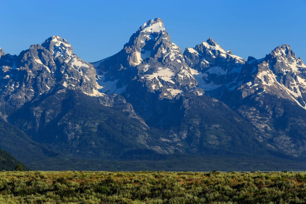
Grays and Torreys peaks, at 14,270 feet and 14,267 feet, respectively, are two of the most popular 14ers mountains in Colorado. They are often climbed as a pair, thanks to an accommodating trail ascending from Stevens Gulch that links the duo in an 8-mile round-trip. Summer weekends find the trail swarming with aspiring hikers, and even mid-week, hundreds of hikers might set out for these two summits. While the social aspect of the day may appeal to some, it turns out there’s a thrilling, less hectic option up Torreys Peak that starts out of the same trailhead: Kelso Ridge.
The start of Kelso Ridge on a perfect, bluebird Colorado morning.
James Dziezynski
Kelso Ridge is a class 3 scramble of mostly solid rock that features a daring, exposed-but-sturdy knife edge section just before topping out. For those looking for a more direct line that promises airy views and fun non-technical (but challenging) scrambling, Kelso Ridge may be worth a visit (if you’re uncomfortable with exposure or off-trail navigation, it may not be for you). However, for the scrambler who loves the thrill of ridges, Kelso may become your new favorite route. It is typically climbed without ropes, though helmets are encouraged.
If you’re tagging Torreys Peak, it’s a 6.75-mile round-trip if descending the standard walk-off trail back to Stevens Gulch. Strong hikers can tack on either Grays Peak or 13,164-foot Kelso Mountain if they want to snag bonus peaks. Grays is actually the easier of the two, but you’ll likely have the off-trail slope walk up to Kelso Mountain to yourself.
Negotiating the towers on the lower section of the climb.
James Dziezynski
Kelso Ridge begins at the low saddle between Torreys Peak and Kelso Mountain. To reach it, begin your hike from the Stevens Gulch Trailhead along the Grays Peak Trail and follow it for 1.8 miles. Here, a small hiker’s trail splits to the right (north) and heads to the low notch, where an old mining cabin sits just below the saddle. This is a good place to put on a helmet and fold away your hiking poles. From here, the summit of Torreys is only about a mile away, but the jagged, cracked ridge looks formidable. Turn west and begin your climb.
While there are no formal trails along Kelso Ridge, the route is scrambled enough that hikers’ trails have been carved into the land. After a short hike to the ridge, a series of rock outcrops appear, each requiring a bit of scrambling. In most cases, there are detours, usually off the right side, that avoid direct scrambles. The good news is that most direct scrambles are class 3 or easy class 4, so use whatever line seems the most suited to your personal tastes. Until about halfway, the ridge alternates between rock outcrops and smooth-ish sections of improvised trail.
Midway through the traverse in a mellow section.
James Dziezynski
Past the halfway point, the route appears to mellow out, especially on a broad section just before the crux of the scramble. The main crux looms just before the final, easy slopes to the top in the form of a large quartz block plastered to ridge and featuring a short (about 15 feet) knife edge that is by far the more daring part of the adventure.
The short but thrilling knife edge crux on Kelso Ridge.
James Dziezynski
Scrambling to the start of the knife edge is in itself a bit heady. The steep, narrow, chute known as the Dead Dog Couloir menacingly waits below. The main knife edge is on very solid rock, though the last seven feet are on a true fin of rock, so scooting across “horsey” style is totally acceptable. The knife edge deposits you on the heart of the quartz block, where one last aftershock of exposure awaits on the easy but initially scary looking but-then-not-so-bad downclimb into the notch at the top of Dead Dog Couloir.
Once you are here, you are home free at 14,100 feet. A short, easy walk up the broad shoulder of Torreys Peak will lead you to the summit, where no doubt a throng of hikers will be hanging out.
Return via the Grays Peak Trail by descending south to the large, broad saddle between Torreys and Grays. It’s a relatively quick and easy detour to grab Grays Peak and the hike down is easy, so if you’re feeling the need for a second 14er, join the crowds and hike over. Follow the trail back through the valley when you are done for either a 6.7-mile day (just Torreys) or roughly 8 miles if you’re tackling both peaks.
Insider Tips
Start early—no later than 6 am if you can help it. Not only does this give you a leg up on incoming storms, it helps you get a parking spot at the trailhead, where parking usually fills up by 7 am, if not earlier.
Helmets are a good idea, since there is some loose rock and a couple of optional scrambles where it’s possible to step up into a rock outcrop.
This is an excellent route that is a perfect example of class 3 terrain in Colorado. It’s solid and exposed in sections, but there’s always a way to back off moves and the fall danger is low. Even the knife edge, airy as it is, can be slowly navigated with a horsey-style shuffle.
For those aiming to scramble Longs Peak, this is a great warm-up hike. While the scrambling on Kelso is a little more hands-on than the standard Keyhole Route on Longs Peak, the exposure is very similar.
Don’t be surprised to see mountain goats on Kelso Ridge—even on the crux!
Strong hikers and scramblers can do this round-trip in four hours or so, but plan to take six for the full journey, especially if adding on Grays or Kelso Mountain.
Past the difficulties near the summit, this view shows the entire ridge.
James Dziezynski
If You Go
From I-70, take the Bakerville exit, Exit 221 from either direction. If coming from the east, turn left and go over a bridge to a large dirt parking lot. If coming from the west, take a right into this lot. Forest Road 189 is a dirt road that climbs into the woods to the south and goes three miles up to the trailhead. While it’s suitable for Subaru Outbacks (SUVs and trucks will be fine) and similar sport-utility cars, the road is rocky, rutted, and bumpy in places.
A good compromise for low-clearance vehicles is to test out the terrain and drive one mile to the junction with Grizzly Gulch. If your car is getting beat up, park here (there’s a road that splits to right, stay straight). The last two miles up alternate between smooth roads and bumpy, rocky sections.
Much of the land on the sides is private. The parking lot is large with space for over 40 cars but gets filled up quickly. There are restrooms and camping is allowed in the woods at 11,280 feet west of the private land. The Grays Peak Trail is well marked and begins here.
Written by James Dziezynski for RootsRated and legally licensed through the Matcha publisher network. Please direct all licensing questions to [email protected]
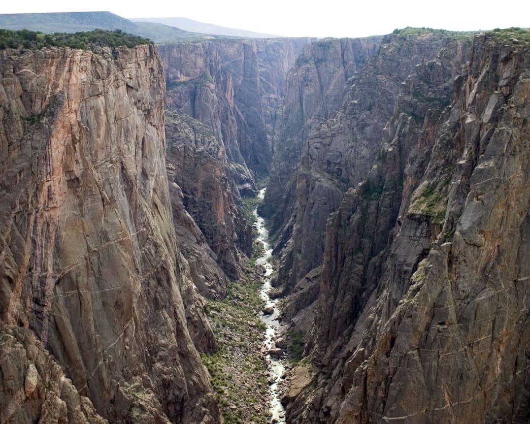
From the surface high above the Black Canyon of the Gunnison, the gash that cuts across the land appears to be little more than a shallow indentation, no different than any other river that that flows through Colorado’s mountain valleys. Only when peering over the rim does the dramatic depth of the sheer cliffs—in places more than 2,000 vertical feet—disrupt the seamless narrative of typical river topography. Mother Nature patiently put her all into splitting open the earth in the Black Canyon, carving out a deep rend in the hide of the planet through some of the oldest known rock in the world.
The “black” in the name Black Canyon comes from its near-perpetual state of shadow and darkness—the canyon only receives a maximum of 33 minutes per day of direct sunlight. The world illuminated at the floor of the canyon has a filter of shade that gives a spooky ambiance to the grey and pale green walls. As these rock walls rise into the light, the striated gray and white faces reveal the intrusion of the lighter colored pegmatite, creating a marbled canvas on ancient stone.
Known for centuries by the local Ute tribe, the first documented exploration of the canyon was by Captain John Williams Gunnison in 1853. Gunnison, who was surveying the area, originally called it the “Grand Canyon” but the river and canyon were renamed in his honor following his death at the hands of Ute warriors alleged to be under the command of Mormon leader Brigham Young (the exact details of his death remain controversial to this day). In the mid 1880s, an audacious act of engineering brought a railroad into the Black Canyon to harvest silver and gold in the region and it remained in operation until 1955. The Black Canyon of the Gunnison was declared a National Monument in 1933 but it wasn’t until 1999 that the 30,750 acre area was upgraded to National Park status.
Classic Adventures
Standing on the rim of infinity, Black Canyon of the Gunnison.
Jake Wheeler
The Blue Mesa Reservoir at the east end of the park belies the gnarly canyon that gradually develops to the west, but it is a great place to camp, paddle on the water, or let your dogs sprint on the beach. Colorado Highway 92 begins here and is the gateway to the heart of the Black Canyon, following the Gunnison River as it seemingly disappears into the earth. There are also campgrounds on both the north and south rims, but if all this seems a little too tame… you’re right!
For the adventurous, the absolute best part of exploring the canyon is the fact there are no established trails leading down, only makeshift paths that involve, wet, sketchy class 3 moves in the best of conditions. Descending into the canyon is an incredible experience and complainers need not apply. Case in point: one route from the northern rim is officially called the S.O.B. Trail. It drops 1,800’ in 1.75 miles (!) along cracked, loose rock, narrow ledges and oh yes, a healthy smattering of poison ivy is deviously tucked into essential handholds. And that’s one of the better ways of getting down into the canyon (and remember, you still have to get back up!) Oh and one more thing: you may have some trouble getting to the bottom, but the local black bears sure don’t—keep your eyes open for the ursine climbers and don’t leave any trash behind.
If there is anything remotely close to an “easy” way down, it would be along the Gunnison Route, a 1-mile, 1,800’ descent that features a section helped by an 80-foot chain. Those who are on the threshold of chickening out will have their best chance to reach the bottom along this route.
There are also several other established routes, none with maintained trails, that reach the canyon bottom. In the heart of the canyon is an amazing world of prehistoric rock, vibrant plants, the casual and unassuming namesake river, and a surprising amount of animal activity. For rock climbers with nerves of steel and solid trad skills, the Black Canyon is paradise. Legendary lines, some upwards of 16 pitches and rarely with difficulty levels below 5.10b, are considered some of the best in the world—for those with the talent to climb them.
Secrets of the Park
View of the Gunnison River along one of the hiking routes.
A scramble down into the canyon is a brag-worthy adventure, but to really absorb the spirit of this dark, exotic landscape, camping in the canyon is without equal. Almost defiantly, there are dozens of campsites in the canyon proper and once again, wimps need not apply. It’s cold, often wet, and for good measure, campfires are not allowed. Some campsites require wading through chilled pools of river water and of course, you’ll have to lug your gear in and out. If this description makes you say to yourself “Bring it on!”, you will not be disappointed. The isolation and solitude is a curious thing; as the crow flies, you’re less than a mile from civilization. But 2,000’ down, locked in by towering rock walls, it feels like you’re a visitor on an unexplored planet just starting to evolve its primitive lifeforms. If you’re tough enough to handle it, the rewards are immeasurable. There is nothing like setting up your tent under the hallowed shadows, the lifeline of the Gunnison River the sole reminder of the world above. Stars glow in the slash of open sky and the dim moonlight casts a pale glow on the canyon contours. Wake in the middle of the night and your mind will ponder if it is still in the midst of a dream.
And for those who are curious, it is possible to kayak through the length of the canyon, but the act borders on sheer lunacy and should only be attempted by extremely skilled paddlers who have no qualms about being battered by the rocks and debris in the fast-moving water.
You will literally be immersing yourself when you take the plunge into the inner canyon. Every trip down has a way of warping time and requires all of your focus and energy to enter into this amazing, dangerous, and daring place. Camping may seem daunting, but if you’re up for the challenge, it’s a wonderful and memorable experience that is nothing like camping in the mountains far above. The prolific wildlife in the canyon proper seems impossible until one considers the fact there are distant ramps of earth that also access the canyon.
How to Get the Most Out of Your Visit
In most other outdoors adventures, you can get away with lazy preparation. Not so here. Make sure you have the proper gear and clothing, plenty of water, enough food, first-aid kit, and a good sense of navigation. Even GPS is marginally useful, as the contours on a topo map are mashed together in steep succession.
It can be wicked cold at the bottom of the canyon, even on a hot summer’s day. For routes that require wading or swimming, make sure your have dry clothes, a towel, and pack whatever you need in a dry bag. The scrambles up out of the canyon are difficult enough, adding in a shivering body and clammy hands makes it even tougher.
Permits are required for all visitors to the canyon proper and they are free. Make sure to get as much information from rangers as you can, they know what they are talking about.
If you can help it, stay out of the river (and in most cases, you can help it). The water rarely gets over 50°F and people have died in the swift, frigid river. The only places where wading is a good idea is in still pools that sometimes block access to campsites and even then, it might be worth reconsidering your options.
There are a limited number of day-use permits and while it’s not normal for them to all be used, you may get shut out if you arrive late on a busy weekend.
Scared yet? Well don’t be! The Black Canyon of the Gunnison is an amazing adventure and dropping into the depths is a great time for those who crave the thrill of exploration. But if that’s not your cup of tea, the upper rim has plenty of wonderful hiking trails along flat, non-exposed trails that lead to incredible viewpoints. The Warner Point Trail is one of the best in the park. At 1.5 miles one-way, it’s the best way to take in all the beauty from afar, though don’t be surprised if the airy distant views still cause a shiver up your spine.
Written by James Dziezynski for RootsRated and legally licensed through the Matcha publisher network. Please direct all licensing questions to [email protected]