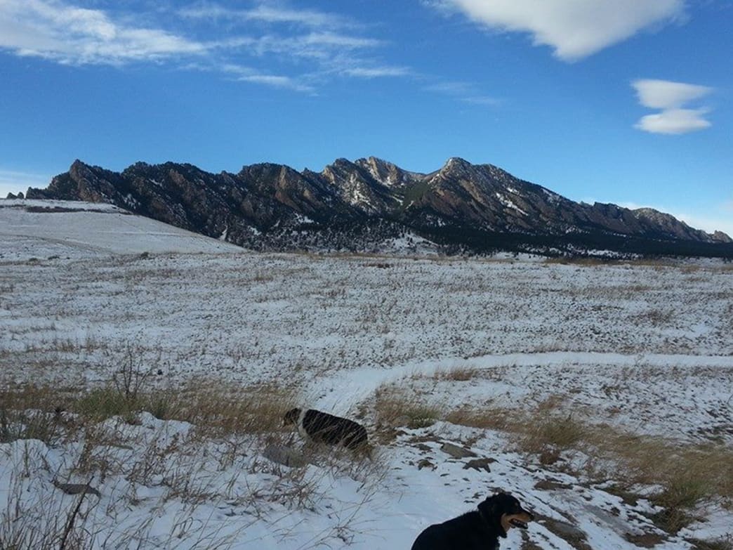
Most Recent

Green Mountain Boulder – Snowshoeing

Intro

Boulder tends to get a few weeks each year where the city has enough powder to use snowshoes right in our own backyards. Luckily, the lofty reaches of 8,144 ft. Green Mountain provide a playground that is suitable for snowy fun throughout the winter — though sometimes a combination of micro-spikes at the bottom of the trail and snowshoes at the top are best. But if there is a big storm, the snowshoeing potential — from bottom to top — is excellent.

What Makes It Great

The standard starting point for winter adventures is the Gregory Canyon Trailhead. As of 2014, the short access road to this trailhead was still damaged from the floods of 2013. Park along the road or at Chautauqua Park for access until it is repaired. It is legal to walk/hike along the closed access road. The best part about hiking Green Mountain is the variety of ways to get to the top. The trails are about 3.2 – 3.5 miles long one way and there are plenty of choices: the steep stairs of the Amphitheater, the gradual grind up Gregory Canyon or the twisty rocks of Saddle Rock. Where these trails merge, the dog friendly Ranger Trail or the hiker-only E.M. Greenman trails will lead to the summit. No matter how you get there, there’s over 2,200 vertical feet to be gained and weather at the top can be quite a bit colder than at the bottom. 

Green Mountain is a treat in the winter. Many aspects of the lower trail still have gashes and damage from the floods; covered in a coat of white snow, they take on new shapes and forms. Spectacular views of the Indian Peaks to the west and Rocky Mountain National Park to the north poke through the trees until coming into full focus near the summit. All the trails alternately climb and flatten out, meaning there are plenty of good spots to catch your breath. And because everything but the summit block is in the trees, you’ll be protected from the icy chill of winter winds. 

Because it is a mountain hike, bring along plenty of warm layers, a headlamp and a warm thermos of tea. Some sections of the trail can get slick when trodden sections ice over and freeze; put those cleats on your snowshoes to good use in these areas!

Who is Going to Love It

Green Mountain is a true winter adventure — without the danger of avalanches, tough access roads or tricky navigation. It’s a great workout with fantastic winter views, so those who want to get a winter mountain fix without leaving town will love Green Mountain.

Directions, Parking, & Regulations

From the intersection of Highway 36 and West Baseline Road, turn west onto West Baseline Road and follow it a little over a mile to Chautauqua Park. As of 2014, parking is available along the road or at the park. The Gregory Canyon Trailhead was closed but will reopen in the future. To reach the trailhead, walk along the road west to a bend. Gregory Canyon Trailhead is blocked to vehicles but is signed and can be accessed by foot.

Dog regulations vary from trail to trail but they are allowed. Dogs with city of Boulder off-leash program tags are allowed off leash in certain areas. Please consult this map to see what areas are on-leash and off leash.

Written by James Dziezynski for RootsRated and legally licensed through the Matcha publisher network. Please direct all licensing questions to [email protected].

Featured image provided by Zach Dischner

Loveland Ski Area – Skiing & Snowboarding

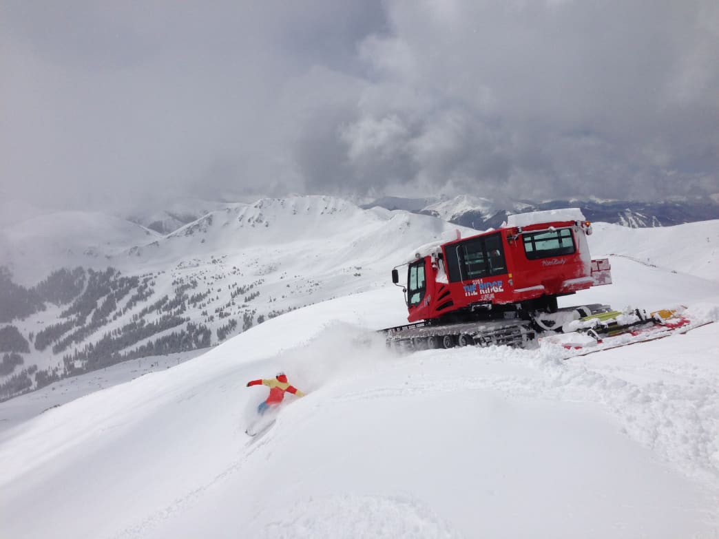
Intro

Loveland Ski Area is one of Colorado locals' favorite mountains. Only 53 miles away from Denver, Loveland offers a wide range of terrain from beginner to expert, without the headache of a crowded resort. Loveland is one of the first resorts to open every winter and typically one of the last to close, giving it a season from around October thru May.

What Makes It Great

Want more time on the mountain and less time in lift lines? Loveland is for you. Loveland sticks to its roots by providing excellent terrain without theexcesses (and the high prices) of other ski areas. It is the perfect place for those that just simply want to ski and ride. The quaint town of Georgetown is 13 miles away and offers a wide range of lodging and restaurants, so if you want to make a weekend of it, you are certainly able.

There are great shops to rent gear from and reasonable rates on lessons. Loveland even offers childcare for kids 12 months to 12 years old.

Much of Loveland Basin is above tree line and it is easy to get into the backcountry if solitude is your venture. The area is one of Colorado’s highest ski areas with a summit of 13,010' and is the second highest lift served area in North America at 12,697'. Free cat skiing is available off of chair 9—make sure to stop by the season pass office to sign a waiver and get a free ridgecat card in order to ride. The ridgecat typically runs Wednesday thru Sunday (weather permitting) from 10am- 2:30 pm. This terrain is only accessible by foot or cat.

Finally, a great addition to Loveland in the past few years is free access to uphill skinning and snowshoe traffic. You'll need to pick up a free uphill pass from the ski patrol office before heading up and you must stay on the assigned routes, but it's an excellent option for those who want to earn their turns.

Who is Going to Love It

Loveland Valley offers beginner terrain and lessons for those just learning to ski, while Loveland Basin offers everything from easy green runs to tons of accessible expert terrain. High above treeline, the gutsy bowls at 13,000' are perfect for experts who want to go big. There's an excellent mix of intermediate and beginner runs as well—laps off Chair 8 are perfect for those dialing in their skills. One more plus: Loveland is one of the very few ski areas in Colorado with reasonable food and drink prices at their cozy lodge.

Directions, Parking, & Regulations

Getting to Loveland is easy! From Denver, take I-70 west to Exit 216, just before the Eisenhower tunnel. Turn right off the exit to park at the main ski area (there is also a smaller lot for parking to the left for beginner terrain).

Written by James Dziezynski for RootsRated and legally licensed through the Matcha publisher network. Please direct all licensing questions to [email protected].

Featured image provided by Dustin Schaefer

Doudy Draw – Fat Biking

Intro

Doudy Draw’s network of trails in south Boulder are fun to ride anytime of year but they will do your fat bike proud when there’s snow on the ground. There’s likely to be a mix of snow, ice, dirt and mud — all ingredients that fat, knobby tires will gobble up with delight. With the completion of the Highway 93 underpass in November 2014, it’s now possible to link up Doudy Draw to Marshall Mesa. That means an expansive amount of trails are available — well over 20 miles, not to mention fun loops at Flatirons Vista and Springbrook Trails.

What Makes It Great

The sheer number of trails to connect means your ride can be less than an hour or all day. Connecting Marshall Mesa’s network of eastern trails means you can ride from Boulder all the way to the town of Superior. Taking the Greenbelt Plateau Trail to High Plains also bypasses Boulder’s enormous windfarm — the towering wind turbines are impressive close up. For a quicker loop, zipping around the Springbrook Trail is a fun way to burn some winter calories in a short time.

The vast majority of the trails are a combination of dirt roads and technically simple paths, though there are a few sections that will get you on your toes, specifically on the connecting hill between Doudy Draw and Flatirons Vista and a few shady sections of the Springbrook Trail. Icy patches are par for the course during melt/freeze cycles, so be ready for them during spells of alternating warm and cold weather. No matter what trails you decide to explore, the views are some of the very best in Boulder. From the upper Mesa, views extend from Longs Peak to the north to the city skyline of Denver to the east. Unlike the mountainous trails to the west of town, the terrain is mostly open prairie interspersed with patches of pine forest. On a bluebird clear winter’s day when there’s a fine chill in the air, the white snow and the low-wattage seasonal sun is a true fat biking treat.

Who is Going to Love It

Fat Bikers who are into long, tour-worthy days will love the accessibility and sheer beauty of Boulder’s less rugged trails. There’s a lot of ground to be covered and plenty of looping options. Though it’s a popular trailhead, crowds quickly disperse. And when your ride is done, there’s lots of good food options five minutes down the road in town (Abo’s Pizza is a great post-ride meal).

Directions, Parking, & Regulations

From the intersection of Highway 93 and Eldorado Springs Drive (Highway 170), turn west onto Eldorado Springs Drive and follow the road 1.8 miles to the Doudy Draw trailhead on the left (south) side of the road.

Note this is a multiuse trail network, so please yield to hikers, runners and horses.

Written by James Dziezynski for RootsRated and legally licensed through the Matcha publisher network. Please direct all licensing questions to [email protected].

Featured image provided by James Dziezynski

Geneva Basin – Backcountry Skiing

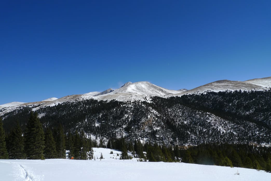
Intro

Thanks to its proximity to a popular fourteener, the Guanella Pass road is lined with cars all summer, but the fun doesn’t have to end when the winter road closure takes effect each November. The long-closed Geneva Basin Ski Area, situated a few miles south of the Guanella Pass summit, boasts an annual snowfall of 300”—on par with Aspen Highlands and Crested Butte, sans the long commute—and enough high-quality runs to keep skiers entertained all day. Backcountry travelers willing to skin the three-and-a-half miles to the base of the ski area are rewarded with a quiet, off-the-beaten-path experience—even on a sunny Saturday.

What Makes It Great

Like much of Clear Creek County, Geneva Basin Ski Area has a colorful history: it was owned for nearly a decade by former Colorado governor Roy Romer, who once joked that buying a resort was cheaper than lift tickets for his seven children. 

Rumors of a ghost—the spirit of Edward Guanella, son of the pass’ namesake—circulated in the 1970s. When a ski lift collapsed in 1984, the resort closed for good, and nature has taken its course in the intervening decades: an old patrol hut (backcountry skiers often spend the night here) and a couple of tiny storage shacks are the only hints that Geneva Basin saw nearly 25,000 skiers in its last season. The beauty of backcountry skiing at an abandoned ski area—aside from the adrenaline rush of skiing through a Michael Crichton thriller set in wintertime—is the number and variety of runs, each just a few minutes’ skin apart. Newcomers to the backcountry will delight in the wide, gentle slopes near the top of the mountain, opting to ski the old cat track back to the meadow when the trails funnel into steeper tree runs—an expert skier’s dream, especially when there’s no shortage of fresh tracks to be had.

Who is Going to Love It

Thanks to the variety of runs, this tour has something to offer everyone from first-timers to seasoned backcountry veterans. Skiers comfortable on blue or more difficult runs at the resort will enjoy this outing the most; narrow runs, unmarked obstacles, and deep, ungroomed snow could present challenges for more novice skiers. The trade-off for a resort without the crowds is that there’s no one to mitigate avalanche danger for you—it’s up to you to know and avoid the dangers. Always carry rescue gear (and know how to use it) when venturing into avalanche terrain.

Directions, Parking, & Regulations

Geneva Basin can be accessed from the Georgetown side, but to maximize your backcountry experience (and shorten your skin), avoid I-70 traffic and take US 285. The Guanella Pass turnoff is in the little hamlet of Grant, about 60 miles from Denver—look for signs on the right-hand side of the road. From here you’ll drive just under seven miles to the winter closure gate and park on the east side of the road. It’s paved and fairly well maintained, but AWD and good snow tires are recommended. No permits or fees are required, and if you’re lucky, you might see the resident posse of majestic bull moose in the meadows southwest of the parking area.

Written by Emma Walker for RootsRated and legally licensed through the Matcha publisher network. Please direct all licensing questions to [email protected].

Featured image provided by Jeremiah LaRocco

Why Are So Many of Outside Magazine’s Best Companies to Work For from Colorado?

Once again, Outside magazine has confirmed what more than five million Coloradans already knew: the Centennial State is an awesome place to live and work. The magazine’s annual list of the 100 Best Places to Work featured 30 Colorado companies in 2015 and 36 in 2016—more than a third of the list, and that number just keeps growing.

"All the outdoor access in the world doesn’t mean much if your job keeps you chained to a desk with no time to enjoy it," Outside writes in the introduction to its yearly list of excellent employers, "The Best Places to Work list represents the cream of the crop—companies that empower their employees to live bigger, better lives.”

Trail running on Green Mountain near Denver. 
    Sean Wetstine
Trail running on Green Mountain near Denver.
Sean Wetstine

The process for selecting that cream of the crop is rigorous. The list is broken into five company categories: Gear, Adventure & Travel, Wellness, Culture, and Advertising. Outside partners with the Outdoor Industry Association and the Best Companies Group, an independent research firm, to survey potential Best Places to Work all over the country. Companies disclose information about workplace policies and the benefits they offer their employees—who, in turn, are asked to evaluate their workplaces on criteria like "corporate culture, policies and perks, role satisfaction, work environment, and overall employee engagement".

Colorado is no newcomer to Outside’s Best Places to Work list: Colorado companies have been showing up in force since its inception in 2011. It’s no wonder the Centennial State is so well represented in categories like Adventure & Travel and Gear—after all, Coloradans are surrounded by infinite opportunities to explore and test new gear. But plenty of Colorado-based companies made the list in non-outdoorsy sectors, too.

When not in use for concerts, Red Rocks Amphitheater is open for free, public workouts.

Sam Howzit

Based on the criteria Outside and the Best Companies Group use, Colorado companies snagged four of the top 10 spots in 2016, including the #1 and #2 seats—those went to Aspen-based interior and architectural design firm Forum Phi and Denver’s GroundFloor Media, respectively. Another 11 Colorado-based companies rounded out the top 30.

The Centennial State’s heavy-hitting presence on the list is in large part because Coloradans really value work/life balance, along with integration of innovation and thought leadership, says Luis Benitez, director of the Colorado Outdoor Recreation Industry Office. He’s got science on his side. A 2012 study published by the Public Library of Science found that creative reasoning and problem solving were improved after participants spent time immersed in natural settings.

Skiing in Colorado—one of the reasons people move to the state.

Zach Dischner

For the sake of work/life balance—and the benefits it brings—Colorado companies on the list offer perks like a weekly beer club, in-office yoga and meditation, quarterly office-wide outside time, paid time for volunteer work, free season-long ski passes, and, in the case of Steamboat-based Smartwool, a policy of mandatory "Powder Days" whenever it snows more than six inches. Several companies also offer unlimited paid time off, allowing their employees to experience what makes Colorado such an incredible place to live—and work.

Written by Emma Walker for RootsRated in partnership with Choose Colorado and legally licensed through the Matcha publisher network. Please direct all licensing questions to [email protected].

Featured image provided by James Dziezynski

Archives